Weather & Geography

Weather
Laos has the typical tropical monsoon (wet-dry) climate of the region, though the mountains provide some variations in temperature. During the rainy season (May to October), the winds of the southwest monsoon deposit an average rainfall of 50 to 90 inches (1,300 to 2,300 mm), with totals reaching some 160 inches (4,100 mm) on the Bolavens Plateau. The dry season (November to April) is dominated by the northeast monsoon. Minimum temperatures average between 60 and 70 °F (16 and 21 °C) in the cool months of December through February, increasing to highs of more than 90 °F (32 °C) in March and April, just before the start of the rains. In the wet season the average temperature is 80 °F (27 °C).
Geography
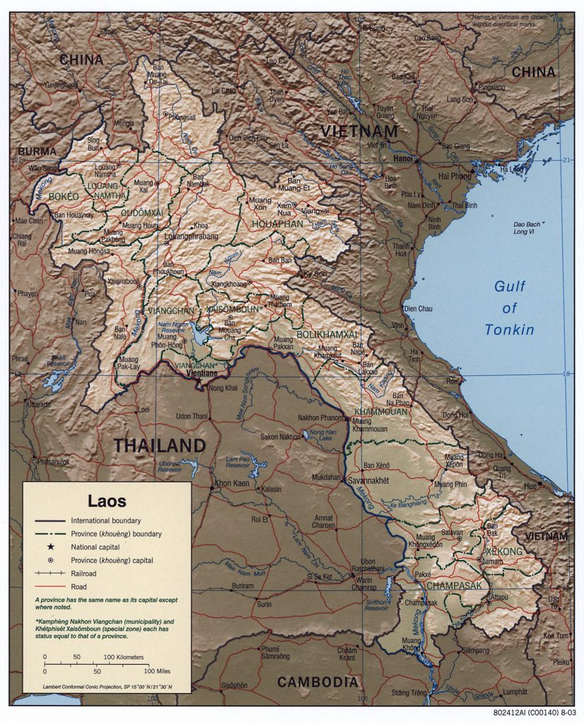
Laos is a country in and the only landlocked nation in mainland Southeast Asia, northeast of Thailand and west of Vietnam. It covers approximately 236,800 square kilometers in the center of the Southeast Asian peninsula, and it is surrounded by Myanmar (Burma), Cambodia, the People’s Republic of China, Thailand, and Vietnam.
About seventy percent of its geographic area is made up of mountain ranges, highlands, plateau, and rivers cut through. Historically, its location has often made it a buffer state between more powerful neighboring states, particularly for the ancestral rulers of the modern-day Burmese, Vietnamese and Thais, as well as a crossroads for trade and communication

Area
Total: 236,800 km2 (91,400 square miles)
country rank in the world: 82nd
Land: 230,800 km2 (89,100 square miles)
Water: 6,000 km2 (2,300 square miles)
Land boundaries
Total: 5,274 km (3,277 miles)
Border countries:
Cambodia: 555 km (345 miles)
China: 475 km (295 miles)
Myanmar: 238 km (148 miles)
Thailand: 1,845 km (1,146 miles)
Vietnam: 2,161 km (1,343 miles)